Posts

Showing posts from June, 2010

280km in Two Day on the Circle Tour

Image
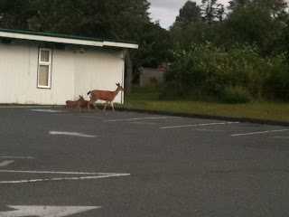
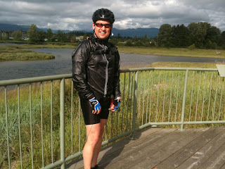
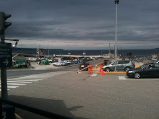
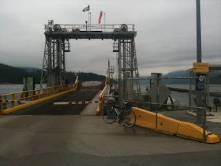
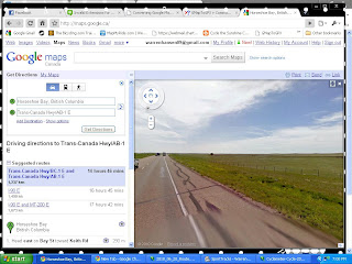
280km and 11:29:40 in two days defines the circle tour around the Georgia Basin aka the Circle Tour.  To summarized my event on the Saturday, I got off the ferry and realized that I only had 40km to complete a Century which is the definitive event in a cyclist goal bucket list.  I picked out my route and ended up completing 160km (100miles) at the end of the day.  To give a better perspective of the distance, just jump in the car at Horseshoe Bay and drive east on the HWY 1 for a little less than 2 hours and you'll hit 160km just outside of Hope, BC.   Anyway, the next day was start of a 120km trip down the coast on the old island hwy and for all intents and purposes I was cycling into headwind all the way!!!! (Actually I just checked the weather data and it was a 30km headwind which equates to a 4% grade uphill for effort).  Here's some pictures:   Picture 1 - Deer and two fawns in Comox Picture 2 - In between Comox and Courtney on the river.  Picture 3 - Fanny Bay Pic

Second day of the Circle Ride starts with Sun!

Image
A great start to the ride in Comox. I've done about 161 km and 6 hour 35 min of riding. 120km to go to Nanaimo.

2nd leg done at Powell River

Image
11:00 am June 26. Whew! Completed the second leg of my journey and I'm at 118km and 4:41 hours into it. This second leg was really pleasant with almost no highway traffic and wide shoulders. I felt really safe here. The shoulder was pretty clean compare to highway 101 near Sechelt. On to Comox and to visit friends to end day ones adventure.

Made it to Earls Cove

Image
Well I'm 85 km into my first day and it's 7:50am in morning! Completed to date - 3:24:31 time, 85.61 km, 25.1 km per hour. Well the first leg was awesome although it didn't start too well. I woke up at 2:45am and took my time to put everything together. Went through my checklist, yep all good to go. I left the house at 4am and it was very dark which required me to use some lights. The first 1/2 hour in the dark was a bit eerie because it was so quiet. About 10 min into the ride I needed a drink of water and no water bottles. Man! It wasn't on my list! So I realized that nothing was open in Gibsons at 4:30 am except for Timmy's which had these pathetic water bottles. Good enough I said and shelled out $3.45 (rip off). There was almost no traffic most of the way which I counted 10 cars. I'm now waiting for the 8:25 ferry where I'll rest, stretch, get sugared up and ride to Powell River for 30km.

Test blog entry

Today is my big two day ride. Will be testing and sending pictures of my trip along the way. ---WAB1234--- Sent from my iPhone

Whats in Suffield Alberta?

Image
June 20 of my Virtual Tour and its the same thing - Flat as hell and grasslands every where!  I end this week just outside Suffield Alberta.  1237km and 51 hours of riding.  Traveling Luck doesn't have much to say about this area.  Except for the Armed Forces Base just north of here, its not very exciting....  http://travelingluck.com/North+America/Canada/Alberta/_6158870_Suffield.html#local_map   ---WAB1234---

Virtual Tour stop at Hwy 842 - Theres Petro Canada Station here

Image
My virtual tour stop of the week at 1082km is at the junction of Hwy 842 and the Hwy 1.  I went on Google Maps and into street view.  There's truck stop and Petro Canada here!  Woo-Hoo!  South on Hwy 842 is the town of Cluny, or something of a town which looks haunted.  A little further south is Blackfoot Crossing Historical Park on the Bow River .   ---WAB123---

Right through Calgary and stopped in Chestermere Lake

Image
My virtual tour this week took me from the Rockies right through Calgary and into Chestermere Lake.  Wiki says Chestermere Lake  is a man-made  reservoir  in  Chestermere ,  Alberta ,  Canada . It was built in the 1880's by the  Canadian Pacific Railway , for irrigation of the area between  Calgary  and  Strathmore . It is presently used mainly for recreation purposes, such as swimming, windsurfing, fishing and skating (in winter). The town of Chestermere surrounds the lake on three sides. The  Trans-Canada Highway  follows the northeastern shore, while the railway tracks pass by the southern shore. The lake covers a surface of 2.65  square kilometres  and has a maximum depth of 7 metres . [1]  It drains into two irrigation canals and is filled via a canal from the  Bow River . The phrase "Chestermere Lake" is actually inaccurate as " mere " means lake in English. With " Chester " an English word derived from the Latin for a defensive fort and meanin